domingo, 31 de marzo de 2013

Un ancien cimetière au pied de la collégiale d'Oiron

Des fouilles préalables aux travaux de réaménagement de la place de l’église d’Oiron ont révélé la présence de nombreux ossements.
Deux tranchées devant l'église collégiale d'Oiron ont réservé aux archéologues d'intéressantes découvertes. Le diagnostic préalable aux travaux de réaménagement de la place des Gouffier a mis au jour de nombreux ossements particulièrement bien conservés, notamment d'enfants, révélant la présence d'un cimetière, probablement avant la construction de l'édifice du XVIe siècle.
Annie Bolle, archéologue, relevait hier la présence d'épingles qui attestent que les corps ont été inhumés dans des linceuls, et de clous provenant de cercueils. Elle soulignait également que les corps avaient été disposés de manière très organisée : l'espace, restreint, a été optimisé. Découverte plus rare : les archéologues ont eu la chance de retrouver parmi les ossements des perles de chapelet.
A l'issue de ce diagnostic archéologique, terminé vendredi, une commission déterminera si le site nécessite des fouilles plus approfondies. Ce qui n'arrangerait pas la commune, qui devrait retarder ses travaux et payer les recherches.
« Le mieux serait de les laisser reposer en paix », commente le maire d'oiron, Gilbert Lang, qui espère boucler le réaménagement de la place d'ici la fin de son mandat, l'an prochain. Les travaux, entamés pour une première tranche – depuis la rue du Château –, prévoient une place séparée en deux par un muret surplombé de planches de bois où s'asseoir. La partie haute restera minérale, tandis que l'espace devant l'église sera pavé, jusqu'à l'accès au domaine viticole.
http://www.lanouvellerepublique.fr/Toute-zone/Loisirs/Patrimoine-tourisme/n/Contenus/Articles/2013/03/30/Un-ancien-cimetiere-au-pied-de-la-collegiale-d-Oiron-1391782

sábado, 30 de marzo de 2013

Snowy landscape reveals Wales' forgotten ancient remains

Archaeologists have discovered ancient remains after they were "brought back to life" by the snow covering the landscape.
Settlements dating back 4,000 years were only found because just the right amount of snow fell on the countryside.
Experts were flying over the landscape in a light aircraft when they spotted the Bronze Age remains below.
A combination of the snow and the low sun in the sky at this time of year provided ideal conditions to plot the sites for the first time.

Archaeologist Dr Toby Driver said: "The snow provides breathtaking conditions for our aerial reconnaissance.
"Snow evens out the colours of the landscape allowing complex earthwork monuments to be seen more clearly and precisely."
The experts on board the four-seater Cessna identified up to 40 ancient earthworks hidden beneath centuries of growth in Mid and South Wales.
They included a 20-metre wide burial mound on common land at Ogmore-by-Sea near Bridgend and a moated site at Llangorse lake near Brecon.
The team were also able to photograph earth works which they already knew about including the remains of a Norman castle at Painscastle near Builth Wells.
Others they were able to map again were the Castle Bank hill fort near Llandrindod Wells, Crugerydd castle near the A44 in Powys and Coedcae Gaer hill fort near Bridgend.
The new discoveries were recorded by the experts from the Aberystwyth-based Royal Commission on the Ancient and Historical Monuments of Wales.
Dr Driver, a team leadrer with the commission, said: "The right depth of drifting or melting snow helps to show up slight differences in topography which can highlight an archaeological site.
"It's as if the snow has brought them back to life.
"It has also highlighted well-known monuments like Painscastle medieval motte and bailey together with previously unrecorded earthworks."
The Royal Commission has been using aerial reconnaissance to identify ancient sites for the last 25 years.
But the recent Arctic conditions which have seen snow laying on the Welsh hills for weeks have given the team a new way of unlocking the
mysteries which cannot be seen from the ground.
Dr Driver said: "Aerial archaeology remains one of the most powerful tools to uncover and document this lost heritage.
"So far well over 5,000 new archaeological sites have been discovered across Wales in 25 years of flying.
"We can now appreciate that Wales was intensively farmed and settled from the Neolithic era 6,000 years ago."


Read more: Wales Online http://www.walesonline.co.uk/news/need-to-read/2013/03/28/snowy-landscape-reveals-wales-forgotten-ancient-remains-91466-33079168/#ixzz2P28ThC00

Mystery unfolds: Monastery unearthed in Taxila valley

Waqas Naeem
ISLAMABAD: The only Buddhist monastery in the Taxila valley was a thriving centre of learning at the end of the third century AD.
The monastery attracted so many students and monks from around greater India that its administration built an annex to house the seekers of enlightenment coming to meditate there, archaeologists at Quaid-e-Azam University (QAU) have discovered.
Another notable finding was that the main compound of the monastery, located in present-day Badal Pur, is at least 300 years older than archaeologists previously estimated. The main compound, which consists of 55 “monk cells”, was excavated between 2005 and 2012.
An excavation mission that began digging at the southern end of the main monastery in March unearthed a new mini-monastery, Dr Muhammad Ashraf Khan, director of the Taxila Institute of Asian Civilisations (TIAC), told The Express Tribune.
Dr Khan, who is heading the ongoing excavation mission, said eight monk cells have been excavated so far at the new monastery, which has a 40 by 40 metre square plan and four metre high walls.
“We were unaware of the existence of this monastery up till now,” Khan said. “When we cleared bushes from the area south of the main monastery, there were visible signs that a structure could be buried underneath.”
The signs were pointing in the right direction, as the archaeologists and students found a structure constructed of stucco — a coating made by mixing limestone, sand and water — and mud plaster in diaper pattern masonry.
This form of masonry pattern, which consists of thin layers of metamorphic rocks interspersed with stone blocks, is associated with Kushan architecture, Khan said.
The Kushans were a tribe that migrated to Gandhara around the first century AD from Central Asia and Afghanistan.
The tribe selected Peshawar as its seat of power and later expanded east into the heartland of India to establish the Kushan empire, which lasted until the third century AD.
TIAC archaeologists believe the new monastery flourished during the late Kushan period, when the Kushans had numerous cultural and trade exchanges with the Buddhists.
Khan said that based on artefacts such as a gold coin with the seal of a second century Kushan emperor found at the larger Badal Pur monastery, the site was believed to be from the same century.
But new evidence suggests otherwise.
Khan said pieces of charcoal found at the monastery were analysed in the US at the University of Wisonsin using carbon dating — a reliable scientific method for determining the age of certain materials.
The university’s report states the monastery was built somewhere around t
he third century BC, making it one of the oldest monasteries in the Gandhara region.
During the excavation of the new, smaller monastery, the team also found a stucco statue of Buddha in meditation, iron objects such as door knocks, pottery, animal bones, coins and a grinding stone. A ‘jar’, which could be the top of a buried stupa, is being excavated at present.
The bones indicate the monastery’s dwellers also domesticated animals.
The bones and coins have been sent for analysis to the Pakistan Museum of Natural History and Punjab Department of Archaeology respectively, Khan said.
A total of 200 students, of masters-level and higher are taking turns participating in the excavation.
“The best part is that our young students get training and practical experience in the principles of archaeology,” Khan said.
He said that due to limited funding from QAU, the TIAC can only commit to short excavation missions. More often than not, sites have to be left unguarded after a brief excavation due to paucity of funds.
Khan said he is trying to get the Buddhist community living in Pakistan to sponsor the excavations and the preservation of important artefacts.
Published in The Express Tribune, March 28th, 2013. 


 http://tribune.com.pk/story/527525/mystery-unfolds-monastery-unearthed-in-taxila-valley/

'Stunning' Stockholm shipwrecks wow experts

Two shipwrecks believed to be 17th-century Danish warships have emerged along the Stockholm waterfront due to unusually low water levels.
I was stunned by how big it was," marine archaeologist Jim Hansson told The Local of the find.

Hansson was out for a stroll along Kastellholmen island with his girlfriend on Sunday, taking in some rare springtime sun, when he noticed a pattern of wooden stumps penetrating the surface.

"If it had only been one or two beams sticking up, I may not have noticed it," he said.

"But I saw immediately that it was a shipwreck. You could clearly see the bow and the stern."

IN PICTURES: Click here to see images of the shipwrecks

Upon further examination of the area, Hansson caught a glimpse of another, never-before-seen wreck.

"I'd heard rumours that it might exist, but I'd never seen any trace of it," he wrote on his blog.

Hansson, who works for the Maritime Museum (Sjöhistoriska museet) in Stockholm, explained that archaeologists have known 
about the existence of one of the wrecks for decades.

Previous examinations revealed that it had been used as the foundation for a bridge, but it had more or less been forgotten since it was found in the 1940s.

However, now that lower-than-usual water levels in Stockholm harbour have made almost the entire wreck visible, archaeologists are taking a closer look

"No one realized just how large the shipwreck was. It's 30 metres long, so the actual size of ship was probably about as big as the Vasa," he said, referencing the famed 17th-century Swedish warship that was recovered from Stockholm harbour and is now on display at a nearby museum.

"There are lots of wrecks around Stockholm but you rarely find anything this big. It's incredible."

After consulting with his colleagues as well as archives at the Maritime Museum, Hansson now believes the wreck is that of the Grå Ulven ('Gray Wolf'), a Danish-built man-of-war that reportedly sunk in Stockholm harbour in 1670.


According to Hansson, the ship has a "fascinating history", having been captured from the Danish navy by the Swedes in 1659 following a skirmish near Ebeltoft Cove in Denmark.

The second wreck may also be a Danish ship known as the Den Stora Draken ('The Big Dragon') and museum officials have since been in contact with their colleagues in Denmark to confirm their theory.

"We know that the wrecks were sunk in the area," Andreas Olsson, head of the Maritime Museum's archaeology section told the Expressen newspaper.

Hansson and his team have spent Thursday taking wood samples from the wreck to be sent for testing to confirm that the wrecks are indeed those of the Grå Ulven and Den Stora Draken.

He expects to have an answer within six to eight weeks.
http://www.thelocal.se/47000/20130328/#.UVXQ3GeyLyB

viernes, 29 de marzo de 2013

Vida, sexo y muerte, bajo las cenizas de Pompeya y Herculano

Su mundo desapareció en 24 horas. Vivían sin saber que bajo las laderas fértiles del Vesubio latía el germen de su propia destrucción, que llegó por sorpresa en el año 79 antes de Cristo. Los habitantes de Pompeya, entre 12.000 y 15.000 personas según se estima, y los de la vecina localidad costera de Herculano, con unos 4.000 habitantes, murieron sepultados por sus propios techos, asfixiados por los gases tóxicos de la erupción, o carbonizados por un flujo abrasador de roca y aire ardiendo que se abalanzó sobre Herculano a 30 metros por segundo y 400 grados de temperatura.
Una nube volcánica de 35 kilómetros llevó la oscuridad a la bahía de Nápoles. La falta de visibilidad impedía la huida a los pompeyanos, que tuvieron unas pocas horas más de vida. Pero su mundo había sido el del aire fresco que disfrutan los actuales visitantes cuando recorren sus calles ordenadas, con el volcán al fondo. Un universo urbano de placeres y gozos cotidianos que desvela con sorprendente ternura la exposición que inaugura mañana el British Museum: «Vida y muerte en Pompeya y Herculano».
La muestra actúa como una varita mágica que insufla vida a las piedras muertas, reconstruyendo con sorprendente eficacia a través de 450 objetos (algunos no habían salido nunca de Italia) aquellas escenas que solo la imaginación del turista podía hasta ahora recrear. Y la vida romana que enseña está muy lejos del rugido de los gladiadores. Pompeya y la pequeña Herculano eran localidades cosmopolitas con una fuerte proporción de esclavos libres entre sus ciudadanos. Se estima que Pompeya debió tener entre 9 y 30 burdeles, la misma ciudad en cuyas paredes se han encontrado más de 50 graffitis con citas del poeta Virgilio. Un mundo de escenas tabernarias y conversaciones de alcoba que lleva a «The Times» a proclamar que «Sexo en Nueva York» ya lo descubrieron los romanos.
«Pompeya y Herculano eran dos ciudades romanas ordinarias que tuvieron un final extraordinario, y es esa ordinariedad la que nos dice tantas cosas de la vida de los romanos», explica Paul Roberts, comisario de una exposición estructurada siguiendo la vida en las calles, primero, y las diferentes estancias de las casas después. En ellas, las familias de Pompeya se retrataban con un sorprendente afán ilustrado e igualitario. Una de las pinturas muestra a «Terentius Neo y su mujer» codo con codo. Él sujeta un pergamino enrollado, símbolo de poder y sabiduría asociado a los cargos públicos, mientras ella se abraza a una tabla de escribir en representación de su estatus intelectual. «El papel de la mujer era muy diferente al de otras sociedades, como la griega», explica Roberts.

Equilibrio entre sexos

Un buen ejemplo es la estatua de la sacerdotisa Eumachia, que guarda todavía el color rojizo de su cabello. Sufragó de su bolsillo el edificio más grande del foro pompeyano, y el reconocimiento que concitaba es evidente. «No quiere decir que fueran iguales, no lo eran, porque no podían votar o asumir cargos públicos, pero mujeres como Eumachia constituyen un nuevo estrato de la sociedad romana», cree.
También las desinhibidas escenas de sexualidad conyugal que muestran algunos de los frescos más llamativos de la muestra apuntan a ese equilibrio (relativo) en las relaciones entre sexos. En un fresco encontrado en la Casa de Lucius Caecilus, la pareja parece entretenida con las posturas sexuales, ella de espaldas, desnuda y reclinada sobre él, mientras un esclavo difuminado al fondo espera sus instrucciones. La pintura colgaba en el patio de la casa, a la vista de todos. Como explican los responsables de la exposición, «los romanos estaban muy habituados a las imágenes de erotismo y sexualidad, que a menudo veían más como símbolos de fertilidad, superstición o, simplemente, de humor».
Es ese sentido del humor el que explica algunas imágenes más subidas de tono, como el de un lascivo sátiro que sujeta el pecho de una ménade, o la estatua del dios Pan en lo que antiguamente se definía como ayuntamiento carnal con una cabra. Esta jocosidad conmocionó a los arqueólogos que la encontraron a mediados del siglo XVIII en un jardín de Herculano, y se enseña en una sala aparte en el Museo de Nápoles. Pero el British Museum ha preferido integrarla en la muestra con un pequeño aviso para los padres. «No hay violencia, es una representación inofensiva y un buen ejemplo del sentido del humor con el que introducían en sus vidas temas como el sexo o la muerte», explica Roberts a ABC.
La vida en el hogar está ilustrada por delicados objetos, como una cuna de bebé de madera recuperada de la ira del volcán, o un banco para hacer una pausa en
los paseos por los patios y jardines, reconstruidos con toda su calma por el museo londinense. En la calle, los residentes menos adinerados buscaban diversión en la tabernas como la de Salvio, de la que se salvaron algunos de los frescos más reveladores de la cotidianeidad pompeyana. «Aquí», exige un cliente al camarero. «No, me toca a mí», contesta otro. Las cocinas, un espacio menor en las casas, muestran las sopas y guisos de lentejas, alubias o cebolla que preparaban cuando estalló el Vesubio. Y la subrepticia presencia de higos cuestiona la trágica fecha del 24 de agosto atribuida a Plinio el Viejo, al ser octubre el mes de esta fruta.

Moldes de escayola para los muertos

miércoles, 27 de marzo de 2013

New finds at Aigai

Three impressive funerary monuments which might open a new chapter to the study of the evolution of the so-called Macedonian Tombs have been discovered.
The tombs, found by Dr. Angeliki Kottaridi (Director, 17th Ephorate of Prehistoric and Classical Antiquities), have been located in the area surrounding the Vergina Town Hall, where a cluster of very important tombs, connected with the Temenidae rulers of Macedonia, had been brought to light 15 years ago.
Of the three tombs, the middle one is described by Dr. Kottaridi as “large, stone-built cist grave, surviving almost completely up to its original height, modestly decorated with blue and red pained bands and with the characteristic stone pedestal that points the position of the funerary bed and the funerary urn placed on its South side”. Another tomb, located south, is described above, was found “very destroyed”.
North of both tombs described above, a very impressive monument came to light. “The tomb, surviving up to the middle of its original height (estimated to reach 4,50 m.), is formed as a wide hypostyle hall measuring 7 X 5 m. Two non-fluted Ionian columns with considerably high square bases, were placed along the building’s axis supporting the stone ceiling while semicolumns –two on each long and two on each narrow wall – were adding grace and elegance. In each of the corners, quarter-columns were placed instead of pilasters […]. A column capital was found next to the western semi-column. Covered with white plaster, the lines of its scrolls painted with blue and its scrolls’ centre painted in red, it repeats a type known from mid 5th century BC monuments. The gate opening, framed by two semi-columns, is located in the middle of the Northern broad side and it could be reached through a monumental stairway. The pedestal connected with the funerary bed and the urn is located straight opposite the gate”, says Dr. Kottaridi adding that “this building, with its unprecedented plan, promises to open a new page to the discussion on the origins of the Macedonian Tombs”.

Still, beyond its architectural plan, the human and animal remains found in this tomb are worth examining. Dr. Kottaridi counts “fifteen horses, several dogs, a dozen of adults, several infants and toddlers” which must had been thrown dead inside the empty and destroyed grave, well after its original use, alongside shards of pottery, tiles, pieces of a marble funerary stele and a magic scroll (katadesmos). The single layer they cover, the position of the bones that shows they supported bodies when they were placed there and the shards that can be restored, point that they were thrown in the tomb at once, during a single tragic incident. This, according to the pottery and a bronze coin, is probably connected to the destruction of Aigai which followed Perseus’ defeat by the Romans in Pydna (168 BC) and the fall of the Macedonian Kingdom.
At any case, all these tombs were found violently looted. This fact might be connected to the destruction of the royal necropolis of Aigai in 276 BC by Pyrrhus the Great Gaul mercenaries –an incident reported by Diodorus. However, traces from the funerary pyres were found during the excavation. A relief in gold, probably part of a shield’s decoration, depicting fighting warriors was found in the cist grave. A golden oak, found also in the cist grave, witnesses that a golden wreath was present in the tomb, meaning that the deceased was a man. The same result comes from finding pieces of a cuirass in the form of scales in the hypostyle tomb, while a number of golden discs carved with the characteristic Macedonian star also survived the looting.
Between the hypostyle and the cist grave, the archaeologists -digging a tiny bit deeper from the ground- found a 15 m. – long floor paved with pebbles as well as pieces of white and colored wall plaster. There are no traces from the original building, due to the removing of its building material for secondary use. However, fragments from alabaster unguentariums and a bronze tinned plate found on the ground probably demonstrate possible funerary cult performance, while a coin of Perdikkas II (454-413 BC), helps to the dating. Fragments of a very big sculpted floral motif with spiral shoots, buds and acanthus leaves recalling the central antefix of the Parthenon came probably from an overground funerary monument, while the stratigraphy indicates that there have been three or four more tombs in the cluster’s area.
“The dig’s completion as well as research and conservation of the finds will help in defining the general image of the area. It is not impossible that new elements will come to light to help us connect these monuments with those people who, from the time of Amyntas I ((530-498 BC) and Alexander I (498-454 BC) up to Philip II(359-336 BC), defined the fate of the Macedonian Kingdom”, says Dr. Kottaridi.
* Dr. Kottaridi presented her work yesterday 20/03/2013 during the proceedings of the annual Conference for the Archaeological Work in Macedonia and Thrace.
 http://www.archaiologia.gr/en/blog/2013/03/21/new-finds-at-aigai/

martes, 26 de marzo de 2013

Ancient Egyptian Cemetery Holds Proof of Hard Labor

Heretic Pharaoh Akhenaten's capital was no paradise for many adults and children


Traci Watson
Published March 13, 2013
Carvings on the walls of the ancient Egyptian city of Amarna depict a world of plenty. Oxen are fattened in a cattle yard. Storehouses bulge with grain and fish. Musicians serenade the pharaoh as he feasts on meat at a banquet.
But new research hints that life in Amarna was a combination of grinding toil and want—at least for the ordinary people who would have hauled the city's water, unloaded the boats on the Nile, and built Amarna's grand stone temples, which were erected in a rush on the orders of a ruler named Akhenaten, sometimes called the "Heretic Pharaoh."
Researchers examining skeletons in the commoners' cemetery in Amarna have discovered that many of the city's children were malnourished and stunted. Adults show signs of backbreaking work, including high levels of injuries associated with accidents.
"We have evidence of the most stressed and disease-ridden of the ancient skeletons of Egypt that have been reported to date," said University of Arkansas bioarchaeologist Jerome Rose (a National Geographic Committe for Research and Exploration grantee), one of the team of experts examining the dead. "Amarna is the capital city of the Egyptian empire. There should be plenty of food . . . Something seems to be amiss."
Amarna was the capital city conjured out of the desert sands in roughly 1350 B.C. by Akhenaten, husband to the famous Queen Nefertiti and likely father of King Tut. Akhenaten rejected the crowded cast of Egyptian gods in favor of the worship of just one, the Aten, or sun god. At Akhenaten's command, the city of Amarna was built some 200 miles (322 kilometers) south of modern Cairo as a place where Aten could reign supreme.
Of the 20,000 to 30,000 people who lived at Amarna during its brief heyday—about 15 years—perhaps ten percent were the wealthy elite, who lived in spacious villas and had lavishly decorated tombs built for them. The rest ended their days in what is known today as the South Tombs cemetery, where most were buried in tightly packed graves marked by piles of rocks.
Secrets From the Graves
In the current issue of the journal Antiquity, the Amarna Project team reports excavating more than 200 graves at the South Tombs site and finding only 20 coffins. Most of the skeletons are instead rolled in stick mats—a likely sign of modest means in a society that deemed coffins highly desirable. One of the cemetery's few coffins is painted with hieroglyphics that can't actually be read, suggesting that the coffin artist, and perhaps the person who commissioned the coffin, were illiterate.
Nor do the tombs contain many of the grave goods found in wealthier burials. The ordinary people of Amarna couldn't have afforded much, but the bareness of their burials may also indicate that grave goods were becoming less important at the time, said archaeologist Anna Stevens, assistant director of the work at the site. Among the few objects found in the graves are three hippopotamus-shaped beads, probably worn by a woman or child before death as protective amulets.
The children of Amarna apparently needed all the protection they could get. Skeletons from those between the ages of 3 and 25 at the time of death show signs of scurvy and rickets, according to research that Kathleen Kuckens, a University of Arkansas student working with Rose, will present at an anthropology meeting in April.
Kuckens will also report that the children's teeth are grooved, a telltale mark of malnutrition. Children older than about 8.5 years showed signs of serious stunting, according to preliminary data that University of Arkansas graduate student Ashley Shidner will also present at the April meeting. It seems likely that those children weren't properly nourished and were engaged in abnormally high levels of physical activity. The children's skeletons show evidence of the constant use of muscles, Shidner said.
Amarna's adults had it no easier than the children. More than 75 percent of the skeletons studied in detail had arthritis in their limbs or spines, suggesting hard labor. Fractured and compressed vertebrae were common, and 67 percent of the skeletons showed signs of at least one healing or healed fracture. Those rates are "really high" and "indicate a high workload," said osteoarchaeologist Jessica Kaiser of Ancient Egypt Research Associates, a group that is excavating around the pyramids of Giza.
Heavy Workload (Literally)
It may be no coincidence that Amarna was built using a recent innovation: a standardized stone building block now known as a talatat, which weighed nearly 155 pounds (70 kilograms) and was judged to be light enough for one worker to carry. A carved scene that probably originated at Amarna shows a man balancing a talatat block across his shoulders, bracing it with both hands. Perhaps, the researchers speculate, hefting stones like that
contributed to the high degree of arthritis among Amarna's workers.
Not all experts think the workload of Amarna's workers was exceptional, though. Skeletons at the ancient Egyptian cemetery called Saqqara also show frequent signs of trauma and physical activity, said Andrew Chamberlain, a University of Manchester bioarchaeologist who has studied the Saqqara remains. Rose responded that although he hasn't seen data for every ancient Egyptian population, many populations show lower levels of workload-related stress than the Amarna common folk do.
After Akhenaten died in about 1336 B.C., Amarna was quickly abandoned. But the South Tombs cemetery has remained to provide a reality check on the propaganda of the pharaoh who hoped to build a place that would be a "House of Rejoicing" for the sun god.
"Amarna was supposed to be this great city where everyone would prosper," said Shidner. "But it wasn't quite the happy place that Akhenaten was making it out to be."

 http://news.nationalgeographic.com/news/2013/03/130313-ancient-egypt-akhenaten-amarna-cemetery-archaeology-science-world/

lunes, 25 de marzo de 2013

scoperta in Grecia una necropoli micenea a Eghion

Una necropoli micenea utilizzata a partire dal XV sec. a.C. e' stata scoperta da un gruppo di archeologi dell'Universita' di Udine presso la citta' greca di Eghion, regione dell'Acaia. Il ritrovamento, informa un articolo apparso sulla rivista ''Archeologia Viva'', e' avvenuto durante la campagna di scavi che l'equipe, guidata da Elisabetta Borgna, ha condotto in localita' Trapeza, un'area collinare vicino a Eghion, poco distante dalla costa sul mar di Corinto.
Finora sono state portate alla luce due sepolture del tipo 'a camera' del XII-XI sec. a.C., molto diffuse in ambito miceneo, costituite da un corridoio di accesso e da una camera funeraria scavata nel pendio della collina. Le ricerche dell'Ateneo friulano hanno permesso anche di comprendere l'origine del culto celebrato sulla sommita' della Trapeza (in greco 'tavola'), un pianoro piatto e regolare da cui il toponimo, dove si trovano i resti di un grande tempio del 500 a.C. circa da cui proviene una preziosa serie di sculture riferibile alla citta' achea di Rhypes (nominata da Pausania nel II sec. d.C.).
I sondaggi hanno documentato una lunga frequentazione dell'altura, a partire dal Neolitico finale (fine IV millennio a.C.) e in particolare durante i secoli che segnano la transizione tra eta' del Bronzo ed eta' storica (Submiceneo-Protogeometrico, XI-IX sec. a.C.).
http://www.antikitera.net/news.asp?ID=12353

domingo, 24 de marzo de 2013

Orpheus Relief Project results in surprise for researchers

In September 2012, researchers at the University of Georgia (UGA) began the The Orpheus Relief Project to determine how a 2000 year old marble relief was originally coloured based on the surviving pigments adhering to the marble, but the final results came as a shock to everyone.
The panel relief consists of the youthful figure of Hermes, the Greek messenger god, which survives from a larger, three-figured composition depicting the god escorting Eurydice to the Underworld during her final parting from Orpheus. This larger composition, known as the Orpheus Relief, is one of the most celebrated examples of Greek sculpture from the High Classical period, ca. 450–400 B.C. that had been copied by the Romans ca. 50 BC-AD 50.

Part of an important collection

The piece formed part of an important collection of Greek and Roman art donated to the University of Mississippi by the estate of famed art historian David Moore Robinson in 1960. UGA was loaned the piece for research as in antiquity, Greek and Roman marble sculpture was not pristine white but colourfully painted and this example had traces of pigment still adhering to the marble.
The relief was the only one of six surviving Roman replicas of the Orpheus Relief known to preserve remains of ancient colouration. This included a red pigment on Hermes’ garments. The art department and the chemistry department from UGA conducted microscopic tests to determine how the piece was coloured two thousand years ago.
Fragment of the Orpheus Relief showing the fragment in location within the full relief panel. Jeff Speakman UGA Center for Applied Isotope Studies examines the sculpture. . Image: UGA

What they found however, was that instead of being a 2000 year old copy, the Orpheus Relief is likely a far more recent historical reproduction.
Project director Mark Abbe says that using microscopy and chemical analysis, they found that the piece was likely created between the 1880’s and the 1920’s. He believes it was a historical reproduction created to decorate a private home in Rome and is a precise replica of a great classical sculpture.

Sold as the real thing

Abbe believes someone probably sold it to Robinson as the real thing. Robinson published an article in 1948 dating the Orpheus Relief to the Roman period, c. 50 BC-AD 50.
The piece had never been scientifically analysed in a laboratory setting until the UGA project. Abbe says that there was an exhibition in Germany in the 1880’s which focused on how ancient marble sculptures were actually vibrantly painted. That generated a lot of interest in the period. He now believes this piece was created after that exhibition, not to fool anyone, but to celebrate the original colours in Greek classical art.
The complete results of the recent study will be presented by Abbe and scientists from UGA in an interdisciplinary presentation “The Orpheus Relief: Object, Three Perspectives” at the Georgia Museum of Art on 28th March 2013.
 http://www.pasthorizonspr.com/index.php/archives/03/2013/orpheus-relief-project-results-in-surprise-for-researchers

Stone Ships Show Signs of Maritime Network in Baltic Sea Region 3,000 Years Ago

Mar. 21, 2013 — In the middle of the Bronze Age, around 1000 BC, the amount of metal objects increased dramatically in the Baltic Sea region. Around the same time, a new type of stone monument, arranged in the form of ships, started to appear along the coasts. New research from the University of Gothenburg, Sweden shows that the stone ships were built by maritime groups.

The maritime groups were part of a network that extended across large parts of northern Europe. The network was maintained largely because of the strong dependence on bronze.
Archaeologists have long assumed that bronze was imported to Scandinavia from the south, and recent analyses have been able to confirm this notion. The distribution of bronze objects has been discussed frequently, with most analyses focusing on the links in the networks. The people behind the networks, however, are only rarely addressed, not to mention their meeting places.
‘One reason why the meeting places of the Bronze Age are not discussed very often is that we haven’t been able to find them. This is in strong contrast to the trading places of the Viking Age, which have been easy to locate as they left behind such rich archaeological material,’ says the author of the thesis Joakim Wehlin from the University of Gothenburg and Gotland University.
In his thesis, Wehlin has analysed the archaeological material from the Bronze Age stone ships and their placement in the landscape. The stone ships can be found across the entire Baltic Sea region and especially on the larger islands, with a significant cluster on the Swedish island of Gotland. The ships have long been thought to have served as graves for one or several individuals, and have for this reason often been viewed as death ships intended to take the deceased to the afterlife.
‘My study shows a different picture. It seems like the whole body was typically not buried in the ship, and some stone ships don’t even have graves in them. Instead, they sometimes show remains of other types of activities. So with the absence of the dead, the traces of the survivors tend to appear.’
One of Wehlin’s conclusions is that the stone ships and the activities that took place there point to people who were strongly focused on maritime practice. Details in the ships indicate that they were built to represent real ships. Wehlin says that the stone ships give clues about the ship-building techniques of the time and therefore about the ships that sailed on the Baltic Sea during the Bronze Age.
By studying the landscape, Wehlin has managed to locate a number of meeting places, or early ports.
‘These consist of areas that resemble hill forts and are located near easily accessible points in the landscape – that is, near well-known waterways leading inland. While these areas have previously been thought to be much younger, recent age determinations have dated them to the Bronze Age.’
The thesis offers a very extensive account of the stone ships. It also suggests that the importance of the Baltic Sea during the Scandinavian Bronze Age, not least as a waterway, has been underestimated in previous research.

 http://www.sciencedaily.com/releases/2013/03/130321082359.htm

 Stone ship in Askeberga, Västergötland, Sweden. (Credit: Image courtesy of University of Gothenburg)

Out of Africa date brought forward

Ötzi the Iceman, a well-preserved natural mummy of a Chalcolithic (Copper Age), who was found in 1991 in the Schnalstal glacier in the Ötztal Alps. Credit: South Tyrol Museum of Archaeology (Phys.org) —A study on human mitochondrial DNA has led to a new estimate of the time at which humans first began to migrate out of Africa, which was much later than previously thought.

Read more at: http://phys.org/news/2013-03-africa-date-brought.html#jCp
The new study by an International group of evolutionary geneticists used mitochondrial DNA from the remains of ancient modern humans to estimate the rate of genetic mutations. Three of the skeletons were from the Czech Republic and dated at 31,000 years old, two were 14,000 years old, from Oberkassel, Germany. Another sample used was the natural mummy Ötzi the Iceman, who lived some time between 3350 and 3100 BC. The most recent skeleton was that of a man who lived in medieval France 700 years ago, while the oldest was dated at 40,000 years ago, and came from Tianyuan in China. The results suggest that the genetic divergence between African and non-African humans began between 62 and 95 thousand years ago, which tallies with other studies estimating the time through dating of stone tools and fossils, but they disagree with the results of recent genetic studies that estimated the migration began much earlier, up to 130 thousand years ago or even before. The previous studies sequenced the entire genome of living humans to count the number of genetic mutations (around 50) in newborn babies compared to the parents to determine the generational mutation rate. This then provided the a molecular "clock," which could be extrapolated backwards to date important events in human evolution. Triple burial from Dolni Vestonice in the Czech Republic. Credit: J. SvobodaThe new study sequenced mitochondrial DNA from fossils of ancient modern humans rather than living humans. The fossils were dated using radiocarbon dating methods. Since the samples were from humans who lived up to 40,000 years ago, mutations that have occurred in the genome since they died would be missing, and the samples provided a range of calibration points for their estimation of the start of the migration. google_protectAndRun("render_ads.js::google_render_ad", google_handleError, google_render_ad);Ads by GoogleArchaeology Field School - 2013 Dig & Student Training Courses Academic Credit NUI Galway Ireland - www.achill-fieldschool.com The disagreement in dating the migration between the new study and previous genetic research could be due to underestimating the number of new mutations in a generation of living humans because of the difficulty of discriminating between true mutations and mistaken ones and because of a desire to avoid false positives. Under-counting would lead to an older estimate for the migration from Africa and other important events. The new date, which agrees with the archaeological evidence, shows that modern humans were in Europe and Asia before and after the most recent glaciation, and they were therefore able to survive and adapt to a dramatically changing climate. The paper was published in the journal Current Biology on 21st March. More information: A Revised Timescale for Human Evolution Based on Ancient Mitochondrial Genomes, Current Biology, 21 March 2013, DOI: 10.1016/j.cub.2013.02.044 www.cell.com/current-biology/retrieve/pii/S0960982213002157

Unearthing Ancient Sweden Through Archaeology

With over 25,000 Iron Age graveyards and burial mounds, 1,140 megalithic structures of all sizes, and about 2,500 large rune stones, Sweden is an archaeologist’s paradise.
While recognized predominantly for its colorful Viking past and picturesque medieval towns, Sweden has a history that extends far beyond the the Middle Ages. In this exclusive interview, James Blake Wiener of the Ancient History Encyclopedia speaks to Dr. Martin Rundkvist, a Swedish archaeologist, about his most recent work in attempting to locate a Geatish mead-hall in the archaeologically rich province of Östergötland. With humor and insight, Rundkvist shares his thoughts and enthusiasm.
JW: Dr. Martin Rundkvist, it is my immense pleasure to welcome you to the Ancient History Encyclopedia! Your work related to ancient Geatish elite structures in Östergötland is most intriguing and I am thrilled to present your expertise with our international audience.
I wanted to begin with a simple question as to why you chose to focus on the Geats (Götar) and their archaeological remains in recent years? Is it because far less research and inquiries have been made on the Geats when compared to the ancient Swedes (Svear) or the Gotlanders (Gutes)?
MR: Thanks for inviting me to speak with you. I studied the province of Östergötland mainly because little had been done about 1st millennium CE elite culture there. This in turn was probably because there is no archaeology department at the University of Linköping.

http://www.pasthorizonspr.com/index.php/archives/03/2013/unearthing-ancient-sweden-through-archaeology

Dredging up the future

WHEN the Saturn V moon rockets blasted off from Cape Canaveral in Florida, their flight paths took them east, over the Atlantic ocean. The Saturns were made up of three stages. When the first had used up all its fuel, two and a half minutes into the flight, it was unceremoniously jettisoned and left to splash into the sea, safely away from any human habitation.
The rocket stages, and the engines that were attached to them, have sat in their watery junkyard for almost half a century. Now, though, they are beginning to return. On March 20th, in a blog post, Jeff Bezos, the founder of Amazon and a confirmed space cadet, announced that his project to bring some of the Saturn’s mighty F1 engines back to the surface had been successful.
It is an impressive feat of engineering, reminiscent of the effort that located the wreck of the RMS Titanic in 1985. NASA’s flight data gave Mr Bezos’s team a rough location to begin the search. They then used sonar to pinpoint the engines’ precise locations. Undersea robots, similar to those used to investigate the Titanic, were sent down through more than 4,000 metres (13,000 feet) of water to confirm the find.
There are a few caveats. It seems Mr Bezos has not managed to recover any complete engines, though he reckons he has enough pieces to cobble together two complete examples. The original goal had been to recover the engines from the most famous flight of all—Apollo 11, whose crew became the first humans to walk on another celestial body. But time, salt water and the effects of smashing into the sea at high speed have left the engines battered and bruised, and the serial numbers on their components (which would enable NASA to identify the specific rocket from which they came) cannot always be read.
When the future becomes the past
Nonetheless, it is the most impressive feat of the new—and poignant, or ironic—field of space archaeology. Space travel has been synonymous with the idea of the future for over a hundred years. The Saturns themselves were in many ways out of their time. At 111 metres tall, they were the size of a small office building, and even half a century later they remain the most powerful rockets ever to have flown. Yet these days, the future that the Saturns represented has become an object of study for those who investigate the past, as the heroic space age dreamed of by science-fiction authors since Jules Verne has resolutely failed to materialise. Ever since the cancellation of the Apollo programme in 1970, astronauts have been stuck in low Earth orbit.
There are plenty of others besides Mr Bezos who are keen to investigate and preserve that vanished future. In 2011, for instance, NASA released high-resolution pictures from its Lunar Reconnissance Orbiter spacecraft, showing the various Apollo landing sites, as well as some of the robotic craft sent to the moon in the 1970s by the Soviet Union. A team of amateur astronomers is attempting to locate the ascent stage of Snoopy, Apollo 10's lunar module, which (intentionally) did not actually land and which was abandoned into a sun-circling orbit. And, spurred by the lunar ambitions of China, as well as by the prospect of visits by privately financed robotic spacecraft under Google’s Lunar X Prize, NASA last year released a document requesting that any new visitors to the moon keep their distance from the Apollo landing sites, in order to "protect lunar historic artifacts".
As for Mr Bezos’s engines, they remain the property of NASA. Raising them from the ocean floor was a passion project. If they can be reassembled, he intends to put them on public display. One will presumably end up at the Smithsonian National Air and Space Museum in Washington, with the other perhaps going to the Museum of Flight in Seattle, near where Mr Bezos lives. There they will join the dusty spacesuits, scorched crew capsules and model rockets that mark a future that never quite came to be.

 http://www.economist.com/blogs/babbage/2013/03/space-archaeology

2,400-Year-Old Myths of Mummy-Making Busted

Ancient Roman Mausoleum No Match for Earthquake

Study concludes that damaged monument resulted from earthquake, not rock fall.
The Romans built their monuments solidly enough to last for millennia, but not without the wear and tear that time, elements and events can produce to turn pristine structures into romantic ruins. Such is the case for a Roman mausoleum that was built below a sheer cliff, commanding a well-designed view of the forum and castle that spread below it in the ancient city of Pinara in Turkey.
In this case, according to researchers at the University of Cologne, much of its damage was caused by an earthquake. It had been knocked off-kilter, its massive building blocks shifted and part of its pediment collapsed. At first, archaeologists and seismologists were not certain how the mausoleum sustained its damage. An earthquake seemed likely, but the mausoleum is also built under a cliff honeycombed with numerous other tombs, and damage from a rockfall seemed possible. To make the determination, research leader Klaus-G. Hinzen and colleagues mapped the position of each part of the mausoleum using laser scans, and transferred 90 million data points collected from the scans into a 3-D computer model of the tomb. They then ran several damage simulations on the 3-D model, concluding that rockfall was not a likely cause of damage, but that an earthquake with magnitude 6.3 would be sufficient to produce the observed damage pattern to the mausoleum's heavy stone blocks.
 http://popular-archaeology.com/issue/march-2013/article/ancient-roman-mausoleum-no-match-for-earthquake

Stone ships show signs of maritime network in Baltic Sea region 3,000 years ago

jueves, 21 de marzo de 2013 University of Gothenburg
In the middle of the Bronze Age, around 1000 BC, the amount of metal objects increased dramatically in the Baltic Sea region. Around the same time, a new type of stone monument, arranged in the form of ships, started to appear along the coasts. New research from the University of Gothenburg, Sweden shows that the stone ships were built by maritime groups.
The maritime groups were part of a network that extended across large parts of northern Europe. The network was maintained largely because of the strong dependence on bronze.
Archaeologists have long assumed that bronze was imported to Scandinavia from the south, and recent analyses have been able to confirm this notion. The distribution of bronze objects has been discussed frequently, with most analyses focusing on the links in the networks. The people behind the networks, however, are only rarely addressed, not to mention their meeting places.
‘One reason why the meeting places of the Bronze Age are not discussed very often is that we haven’t been able to find them. This is in strong contrast to the trading places of the Viking Age, which have been easy to locate as they left behind such rich archaeological material,’ says the author of the thesis Joakim Wehlin from the University of Gothenburg and Gotland University.
In his thesis, Wehlin has analysed the archaeological material from the Bronze Age stone ships and their placement in the landscape. The stone ships can be found across the entire Baltic Sea region and especially on the larger islands, with a significant cluster on the Swedish island of Gotland. The ships have long been thought to have served as graves for one or several individuals, and have for this reason often been viewed as death ships intended to take the deceased to the afterlife.
‘My study shows a different picture. It seems like the whole body was typically not buried in the ship, and some stone ships don’t even have graves in them. Instead, they sometimes show remains of other types of activities. So with the absence of the dead, the traces of the survivors tend to appear.’
One of Wehlin’s conclusions is that the stone ships and the activities that took place there point to people who were strongly focused on maritime practice. Details in the ships indicate that they were built to represent real ships. Wehlin says that the stone ships give clues about the ship-building techniques of the time and therefore about the ships that sailed on the Baltic Sea during the Bronze Age.
By studying the landscape, Wehlin has managed to locate a number of meeting places, or early ports.
‘These consist of areas that resemble hill forts and are located near easily accessible points in the landscape – that is, near well-known waterways leading inland. While these areas have previously been thought to be much younger, recent age determinations have dated them to the Bronze Age.’
The thesis offers a very extensive account of the stone ships. It also suggests that the importance of the Baltic Sea during the Scandinavian Bronze Age, not least as a waterway, has been underestimated in previous research.
 http://www.alphagalileo.org/Organisations/ViewItem.aspx?OrganisationId=2250&ItemId=129604&CultureCode=en

Un curso de arqueología egipcia será impartido por Mari José Noain

Un curso impartido por Mari José Noain, directora del Museo Romano Oiasso, de Irun ,tendrá lugar en Eibar, en colaboracióncon Aulas Kutxa. Este curso de Arqueología de Egipto comenzará el día 17 de Abril. Mari José Noain es profesora y arqueóloga; responsable de actividades del Museo Romano Oiasso de Irun, en donde realiza una gran labor de difusión delas culturas y patrimonio antiguo. El curso es de cinco sesiones y tendrá lugar en Armeria Eskola. Se trata de clases, para todos los públicos, a partir de los 16 años, que se ofrecerán en cinco miércoles, desde las 17.30 a 19.30 horas. Las inscripciones para la matrícula pueden hacerse en el teléfono: 902540040. Más información en el tlfno: 636022704.


http://www.diariovasco.com/v/20130322/alto-deba/curso-arqueologia-egipcia-sera-20130322.html

Encroachment continues on Egypt's archaeological sites, Al-Bordan

Egypt antiquities police and archeologists stop illegal construction at Al-Bordan archaeological site on Alexandria-Marsa Matrouh highway, yet damages completely destruct site
Nevine El-Aref , Saturday 23 Mar 2013
Al-Hamam Antiquities Inspectorate has succeeded to remove encroachment on Al-Bordan archaeological site, located on Alexandria-Marsa Matrouh highway, in collaboration with Egypt’s tourism and antiquities police.
The site includes remains of Graeco-Roman fortresses, roads, temples and cemeteries.
The encroachment on the Al-Bordan archaeological site, located on kilometre 67 on Alexandria-Marsa Matrouh highway, started Friday when a large truck invaded the site with a construction bulldozer, which on its turn damaged a cluster of authentic structures that date back to the Graeco-Roman era, according to director of Marina Al-Alamein Antiquities Khaled Abul-Magd.
Abul-Magd accused Yasser Khalil, owner of a contractor company, and truck driver Mohamed Abdel Sattar of violating and damaging the archaeological site. The tourism and antiquities police arrested both accused, but they denied all charges. Both are in custody until the completion of investigations.
On Saturday, all encroachment has been removed, but the site is almost completely damaged.
Egypt has reportedly suffered from illegal urban and agricultural encroachment on archaeological sites.
Earlier in March, residents of neighbouring Al-Hagg Qandil village began cultivating the area around a collection of 18th-dynasty noblemen’s tombs at the ancient site of Tel Al-Amarna in the Upper Egyptian city of Minya, which was Egypt's capital during the reign of monotheistic pharaoh Akhenaton.
Minya’s archaeological inspectorate sent a report to both local police and the antiquities ministry.
The ministry ordered a halt to the encroachment and stepped up security in the area, while tourism and antiquities police were deployed nearby.
Dahshur, 30 km north of Giza plateau, was subjected to violation in January 2013. Residents of the neighbouring Dahshur village proceeded to construct a collection of modern cemeteries before the Black Pyramid of King Amenhotep II.
However, Dahshur residents halted construction of the structures after the antiquities ministry offered to provide them with land far from the archaeological site on which to build a cemetery.

 http://english.ahram.org.eg/NewsContent/9/40/67531/Heritage/Ancient-Egypt/Encroachment-continues-on-Egypts-archaeological-si.aspx


Mummy Myths Debunked By New Study Of Ancient Egyptian Embalming Practices

By: Tia Ghose, LiveScience Staff Writer
Published: 03/22/2013 12:51 PM EDT on LiveScience
Contrary to reports by famous Greek historian Herodotus, the ancient Egyptians probably didn't remove mummy guts using cedar oil enemas, new research on the reality of mummification suggests.
The ancient embalmers also didn't always leave the mummy's heart in place, the researchers added.
The findings, published in the February issue of HOMO – Journal of Comparative Human Biology, come from analyzing 150 mummies from the ancient world.
Mummy history
In the fifth century B.C., Herodotus, the "father of history," got an inside peek at the Egyptian mummification process. Embalming was a competitive business, and the tricks of the trade were closely guarded secrets, said study co-author Andrew Wade, an anthropologist at the University of Western Ontario.
Herodotus described multiple levels of embalming: The elites, he said, got a slit through the belly, through which organs were removed. For the lower class, mummies had organs eaten away with an enema of cedar oil, which was thought to be similar to turpentine, Herodotus reported. [See Images of Egyptian Mummification Process]
In addition, Herodotus claimed the brain was removed during embalming and other accounts suggested
the heart was always left in place.
"A lot of his accounts sound more like tourist stories, so we're reticent to take everything he said at face value," Wade told LiveScience.
Mummy tales
To see how eviscerations really took place, Wade and his colleague Andrew Nelson looked through the literature, finding details on how 150 mummies were embalmed over thousands of years in ancient Egypt. They also conducted CT scans and 3D reconstructions on seven mummies.

sábado, 23 de marzo de 2013

Cambridge dig unearths history from Bronze Age to World War II

An archaeological dig in Cambridge has revealed the site's history from the Bronze Age to its role in World War II.
Excavation of the site in the north-west of the city began in October, ahead of a large-scale University of Cambridge development.
Roman roads and World War II practice trenches were amongst the discoveries.
Christopher Evans of Cambridge Archaeological Unit said: "Something that is going to be vibrant in the future was also vibrant in the past."
Archaeologists believe the site was first colonised for settlement in the Bronze Age and subsequently saw an Iron Age settlement.
'Surprise find'

Mr Evans said the dig was the one of the largest excavations to have taken place in Cambridgeshire and had unearthed a "thriving" Roman settlement, from around 60-350AD.
"The site is 1,200m long, it's covering 14 hectares," Mr Evans said.
"We're investigating this great gravel ridge and finding dense Roman settlement almost continuously along the length of it."
Four Roman cemeteries and 25 human skeletons, some with their skulls missing, have been discovered along with thousands of other remains.
Archaeologists said it was a surprise to find the zigzag ditches thought to be part of Cambridge's defence preparations for the war.
Mr Evans said: "It all testifies that things change and that archaeology often erodes long-held landscape stereotypes.
"It's part of what makes fieldwork so exciting."
 http://www.bbc.co.uk/news/uk-england-cambridgeshire-21893150

viernes, 22 de marzo de 2013

Hallan una túnica previkinga tras el deshielo de un glaciar noruego


MADRID, 22 Mar. (Reuters/EP) -

   Una túnica de lana de época previkinga, encontrada junto a un glaciar en deshielo en el sur de Noruega, muestra cómo el calentamiento global se está convirtiendo en una bendición para la arqueología, afirman los científicos responsables del hallazgo.

   La holgada prenda de color marrón grisáceo, adecuada para una persona de 1,76 metros de altura, fue encontrada a 2.000 metros sobre el nivel del mar en lo que podría haber sido una ruta comercial de la época romana en el sur de Noruega. La datación por radiocarbono mostró que fue fabricada en torno al 300 d.C.

   "Es una pena que se estén descongelando los glaciares, pero es algo emocionante para los arqueólogos", dijo Lars Piloe, un arqueólogo danés que trabaja en los glaciares noruegos, en la primera exhibición pública de la túnica, que ha sido estudiada desde que se encontró en 2011.

   Un guante y un bastón ornamentado vikingos del 800 d.C., un zapato de cuero de la Edad de Bronce y antiguos arcos y cabezas de flechas utilizados para cazar renos están también entre las 1.600 piezas encontradas en las montañas del sur de Noruega desde que el deshielo se acelerase en 2006. "Esto es sólo el comienzo", dijo Piloe, augurando nuevos descubrimientos.

GLACIARES EN DISOLUCIÓN

   El descubrimiento en 1991 de Otzi, un hombre prehistórico que deambulaba por los Alpes hace 5.300 años entre Austria e Italia, es el hallazgo más famoso encontrado en un glaciar. En los últimos años, ha aparecido material arqueológico desde Alaska hasta los Andes, en muchos casos debido al deshielo de los glaciares.

   La fusión está causada por el cambio climático, provocado por las emisiones de gases de efecto invernadero de origen humano a partir de la quema de combustibles fósiles.

   Los arqueólogos dijeron que la túnica mostraba que el glaciar Lendbreen de Noruega, donde fue encontrada, no era tan pequeño desde el 300 d.C. Con la exposición al aire, los tejidos antiguos sin tratar pueden desintegrarse en semanas a causa de los ataques de insectos y bacterias.

   "La túnica estuvo bien utilizada, fue reparada varias veces", dijo Marianne Vedeler, una experta conservadora del Museo de Historia Cultural de Noruega.

   La túnica está hecha de lana de oveja con un adorno de diamante ennegrecido con el tiempo. Sólo un puñado de túnicas similares han sobrevivido tanto tiempo en Europa.

   Para los expertos en Oslo una de las grandes incógnitas es por qué alguien dejaría una cálida túnica en un glaciar.

   Una posibilidad es que el propietario padeciera una hipotermia en una tormenta de nieve, que en algunas ocasiones provoca la falsa sensación de calor que lleva a quitarse ropa a los que la sufren.
http://www.europapress.es/ciencia/noticia-hallan-tunica-previkinga-deshielo-glaciar-noruego-20130322104701.html

jueves, 21 de marzo de 2013

Descubierta una mina de oro romana

El yacimiento puede llegar a ocupar 150 hectáreas. Es el primero de estas características que aparece en A Mariña, entre Foz y Barreiros


Las jornadas micológicas dan a veces frutos inesperados. Sobre todo cuando el amante de las setas sabe leer los mensajes ocultos bajo los montones de piedras y las formas onduladas del terreno, que no acostumbran ser caprichosas. En A Mariña coincide que hay varios de estos aficionados al níscalo y el cantarelo que además son capaces de emocionarse ante un petroglifo, una mámoa o lo que podría parecer el parapeto de un castro.
La última vez, en Foz, cesta de mimbre en mano, lo que creyeron toparse dos de estos vecinos de la comarca lucense fue precisamente eso, un parapeto y el consiguiente foso. Pero pasó que después de este foso se levantaba otro parapeto, seguido nuevamente de un foso, y de otro parapeto y otro foso. Parecía una sucesión eterna. La fortificación semejaba excesiva, imposible, y entonces Manuel Miranda, que era precisamente uno de los dos colectores de setas, se llevó la duda a casa tras la excursión. Y no se le ocurrió mejor cosa, a quien también ejerce de portavoz del colectivo Mariñapatrimonio, que empezar a despejar su intriga repasando la toponimia de la zona.
Rego Grande, Pozo Mouro, Quebradoiro, Cal, Furada, Piego, Meixador, por la banda de Foz. Lagoa, Covas y Carral, ya al otro lado del límite municipal, en el ayuntamiento de Barreiros. “Nos dimos cuenta de que muchas de estas palabras hacían referencia al agua, a las conducciones, a los pozos, y que eso tenía que indicar algo”, explica Miranda. “Cal es canal; Piego es piélago, que en castellano tiene también la acepción de estanque; Meixador es, según algunos estudiosos de la toponimia, un lugar por donde se vierte agua; Carral es, entre otras cosas, un lugar con surcos que recuerdan el rastro de las ruedas de los carros”.
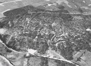
Los miembros de Mariñapatrimonio, un grupo que en el último lustro ha informado a la Xunta de numerosos hallazgos arqueológicos que nadie antes había identificado, comprobaron que aquella extraña estructura de fosos y parapetos encontrada en el lugar de A Espiñeira (Foz) tenía su continuidad en la vecina zona de As Covas, al borde de la ría, en Barreiros. Y descubrieron otros signos, como unos montículos de cantos rodados que bien podían ser murias, las escombreras que dejaban a su paso los romanos después de explotar una mina. Las fotos aéreas que consultaron en Internet no ayudaban mucho. La zona está repoblada con pinos y eucaliptos que apenas dejan ver el suelo desde el cielo. Hasta que, buscando con paciencia, se toparon con imágenes en blanco y negro, del año 56. Ahí la vegetación todavía no había crecido, y el terreno aparecía dibujado de surcos que desembocaban en otros canales más grandes, ladera abajo.
Imagen área del año 56 que sirvió de pista para identificar la mina
Por entonces, y ya con la sospecha de que aquello se trataba de una mina, habían telefoneado al arqueólogo Santiago Ferrer, uno de los mayores expertos gallegos en yacimientos romanos, que dirige en Bande la excavación del campamento militar de Aquis Querquennis siempre que lo permite el nivel de las aguas (las ruinas duermen buena parte del año sumergidas en el embalse de As Conchas). Según Miranda, cuando le enviaron la vieja foto aérea, la respuesta de Ferrer fue rotunda. No cabía duda de que se trataba de una mina de oro romana, con canales, balsas y depósitos para el lavado y la decantación del mineral. Nadie antes había sospechado que en A Mariña se hubiese extraído oro. Es la primera mina que aparece, y según Mariñapatrimonio, a juzgar por las estampas aéreas, podría alcanzar unas dimensiones enormes: 150 hectáreas de terreno repartidas entre Foz (50 hectáreas) y Barreiros (unas 100). Efectivamente, si así fuese, se trataría del aurífero romano más grande de Galicia, y el único conocido que lavaría el metal precioso no en dirección a un río, sino a una ría.

Pero el arqueólogo, que visitó el lugar con miembros de Mariñapatrimonio y el alcalde de Foz, es cauteloso. Según él, lo que de momento se puede decir de este yacimiento es que se encuentra en buen estado de conservación y que es “novedoso”, porque “nadie imaginaba que pudiera existir”. Miranda añade que esta mina, “una obra de ingeniería bestial”, podría explicar la abundancia de castros en la zona. Alrededor hay registrados 20 asentamientos que pudieron haber surgido para alimentar de mano de obra el filón. Se supone que los técnicos que dirigieron la construcción del complejo sistema de canales y compuertas eran ingenieros de la Legio VII Gemina, es decir, de León. La mina era propiedad de Roma, y los pobladores castrexos pagaban los impuestos al Imperio con su trabajo y las pepitas de oro que con él obtenían.
La actividad pudo llegar a extenderse, como en el resto de las minas romanas, del siglo I al III. “Entonces, todas se abandonaron”, ilustra Santiago Ferrer. “Se cree que en algún momento se dio una fluctuación en el precio del mineral. Bajó mucho y ya no interesaba... No, no fue porque se acabase el oro. El oro todavía sigue estando”.

 http://ccaa.elpais.com/ccaa/2013/03/20/galicia/1363807616_744311.html